Firecams
We now have firecams up on the website! They can sense fire and automatically alert interested parties.
The two cams at the bottom of this page are the new ones:
Fire Danger
Archive for Fire Danger
We now have firecams up on the website! They can sense fire and automatically alert interested parties.
The two cams at the bottom of this page are the new ones:
We’re starting to get into our fire season and it’s always a good idea to prepare or freshen up your Go Bag. Talk to family, friends, neighbors and make a plan! Decide where to meet, where to stay, where you are going. If you have pets plan ahead for them as well and have prepared go bags for them. If you do not have a car, make a plan ahead of time. Ask a friend or a neighbor ahead of time, if you can ride off the hill with them. If you have a car, keep 1/2 tank of gas in it at all times. If the power goes out, the stations may not be able to pump gas unless they have a generator and even then they may only be able to take cash payments. Remember, in case of an emergency the number one priority is safety first. Proper advanced preparations can ease the stress of evacuation and help you make sure all the necessities are not left behind or forgotten.
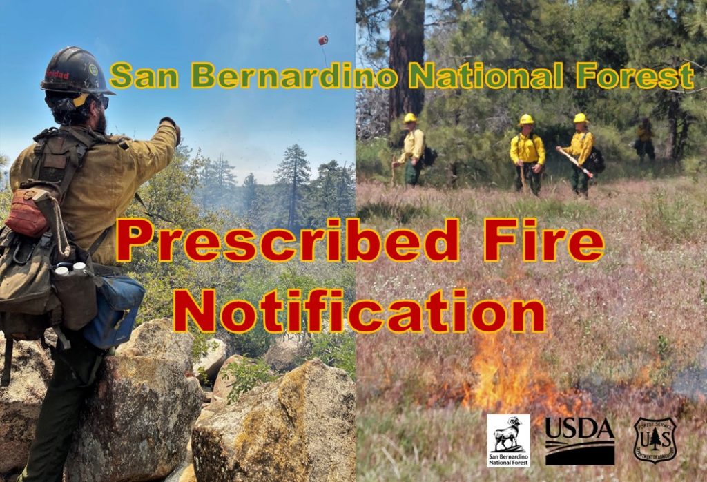
Fire Personnel to Implement the Thomas Mt. Prescribed Fire Project starting June 10
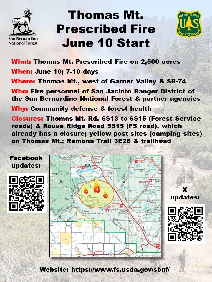
The San Jacinto Ranger District of the San Bernardino National Forest plans to conduct a prescribed fire on Thomas Mountain, starting June 10.
The operation is planned to last from seven to 10 days. The district intends to complete approximately 2,500 acres; the district prescribed burned 2,500 acres on Thomas Mt., in the summer of 2023.
Road closures will include Thomas Mountain Road 6S13 to 6S15 (Forest Service roads) and Rouse Ridge Road 5S15 (Forest Service road), which already has a closure. There will also be a closure of Forest Service yellow post sites (camping sites) on Thomas Mountain. The Ramona Trail 3E26 will also be closed. These closures will be implemented for the safety of the public and fire personnel. Personnel will be driving large vehicles while conducting the burn and patrolling the area.
Smoke and flames will be visible during the day and night. Staff and resources will be stationed overnight.
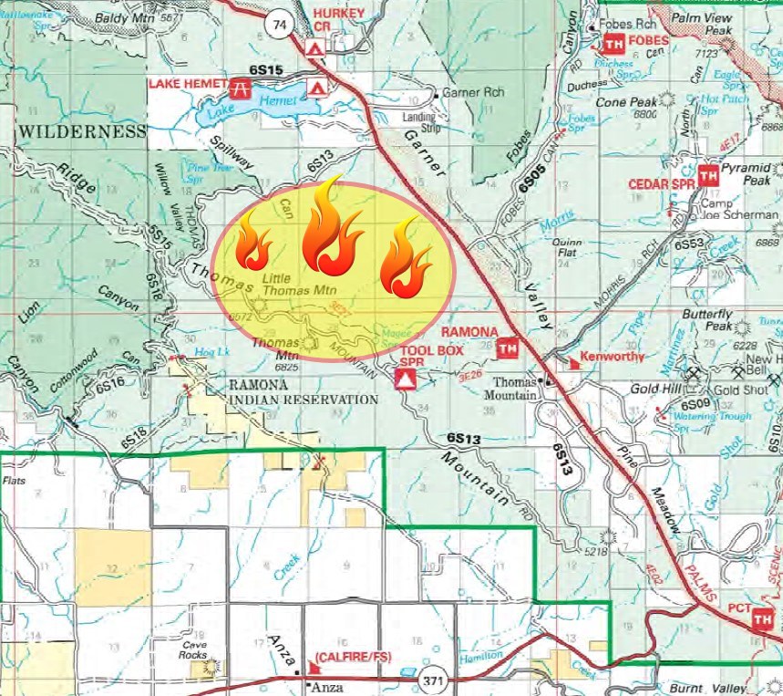
The Thomas Mountain Prescribed Fire project is located immediately west of State Route 74 and the community of Thomas Mountain. It is south of Lake Hemet. Other communities in the vicinity include Idyllwild, Garner Valley, Mountain Center, Pine Cove, Anza, the Santa Rosa Tribe Reservation, the Cahuilla Tribe Reservation and the Ramona Band of Cahuilla Tribe Reservation.
See the full news release at: https://www.fs.usda.gov/detail/sbnf/news-events/?cid=FSEPRD1177296&fbclid=IwZXh0bgNhZW0CMTAAAR3Yj6KFKQLk_okrfzv5W1xt0uR0zUel6xhLym45JC6BV1EkT4kxCyCFuB4_aem_AfrXivwm-2IAIcE-ERSupALgYyf-o8aNwc70n04Z1VL3Q7TqcKHjf4wsVVQJL1_sbm4PwjYYa1LGbL40Sn8ZHTXB
When was the last time you updated the batteries in your smoke detectors, carbon monoxide detectors, etc.? We are heading into fire season and if you haven’t done so, now is the time.
Stay safe.
~Jennifer
October billing went out this week. If you get emailed bills, you should’ve already received yours.
This months mailed billing includes a notice from Cal Fire regarding Wildfire Actions and Low cost Retrofitting and Defensible Space. In case you don’t get the paper mailing, I’ve attached those items here.
Water bills are mailed around the 1st of the Billing Month (even months). All bills are due and payable by the 1st of the following month (odd months). Any bill not paid by the due date will be termed delinquent and subject to a $15.00 late fee and/or termination. If shut off, a reconnect fee of $75.00 will be charged, in addition to current amount due, to re-establish service.
There are several ways to pay your bill.
ACH Auto Draft is a free service; the payment is automatically taken out of your bank account. (filled out form required).
You can log on to your account online, and pay with a Visa/Mastercard/Discover, or E-check. To register your account online, you will need your account number, and the Municipality Code which is PineCoveWDCA. Go to www.pcwd.org and click the “Billing” tab and the Payment option link. Next, click on the www.ub-pay.com link and register your account from there.
You can come into the office and pay by check, cash, or card. One person at a time with a mask.
Drop payments thru the slot on the front door or mail a check or money order.
Please note that there is a convenience fee of $3.00 per hundred dollars charged if using a credit card.
Just a quick update that I received from Jon King and his San Jacinto Trail Report. Want to see the full report? Click here and give him a follow.
Full fire restrictions are in place on Forest Service lands, as described here. All campfires anywhere in the San Jacinto mountains, including at all USFS campgrounds and yellow post sites, are now prohibited. The total fire ban has finally been extended to Riverside County lands starting 23rd August, including for example the Hurkey Creek campground (thanks to Dan Roberts for updates on the county situation).
The U.S. Forest Service ranger station in Idyllwild remains closed due to USFS coronavirus protocols. Apparently it is unlikely to reopen before October, but possibly much later. Hiking and camping permits are nevertheless required for USFS lands, and should be available at the kiosk outside the ranger station. The State Park ranger station reopened about six months ago.
WEATHER A few days of temperatures around (or even below!) seasonal for the first time in two months came to an end early this week. Daytime high temperatures will again be above average for August starting Wednesday 25th, with overnight low temperatures in particular being well above seasonal, before cooling again to about average in the first couple of days of September. As mentioned above, monsoonal rains are a possibility from 29th August to at least 2nd September. Fire risk remains severe.
We’re starting to get into our fire season and it’s always a good idea to prepare or freshen up your Go Bag. Now is the time to make sure any non-perishable foods are up to date, fresh water replaces last year’s water, chargers are charged, and more in case of an emergency. I have 1 bag by the front door and 1 in my truck.
Build an Emergency Evacuation Kit Including:
Talk to your family, friends, neighbors and make a plan! Decide where to meet, where to stay, where you are going. If you have pets plan ahead for them as well and have prepared go bags for them. If you do not have a car, make a plan ahead of time… ask a friend or a neighbor ahead of time, if you can ride off the hill with them. If you have a car, keep 1/2 tank of gas in it at all times. If the power goes out, the stations may not be able to pump gas unless they have a generator and even then they may only be able to take cash payments. Remember, in case of an emergency the number one priority is safety first. Proper advanced preparations can ease the stress of evacuation and help you make sure all the necessities are not left behind or forgotten.
Posted in: Community, Earthquakes, Emergencies, Fire, Fire Danger
Leave a Comment (0) →Last week we had quite the wild weather! The thunder and lightening storm on Thursday afternoon was pretty intense. The thunder was so close and so loud it sounded like it was sitting right on top of Pine Cove. The hail was a surprise as well. I actually saw the snow plow go by my house! You just never know what is going to happen here on the mountain. While all moisture is welcome, that was a bit much for the end of May.
This week the forecast is for something much calmer luckily.
As we move into the summer season, please be mindful of the extreme fire danger that is ever present. Over Memorial Day weekend, one of our board members spotted 3 different visitors to the hill, flicking cigarette butts out of their car windows. It will only take one to light a forest fire. Please remind all your guests who visit you here on the hill, to be mindful as well. And be sure to do your fire abatement around your mountain home and property. It is important that everyone comply with this because if you don’t, you can put not only yourself in danger, but your neighbors and the whole hill as well.
Tags: fire, fire abatement, fire prevention, safety, weather
Posted in: Fire, Fire Abatement, Fire Danger, From the Office
Leave a Comment (0) →Hold on to your hats! We are under a high wind warning until 4 p.m. this afternoon. There is also a red flag warning until 8 p.m. tonight.
* WINDS…AREAS OF EAST WINDS 25 TO 35 MPH…WITH GUSTS UP TO 65
MPH. ISOLATED GUSTS UP TO 85 MPH ON WIND PRONE SLOPES.
WIND…AREAS OF EAST TO NORTHEAST WINDS 25 TO 35 MPH…WITH
GUSTS TO 65 MPH. ISOLATED GUSTS TO 85 MPH. WINDS STRONGEST ALONG
THE COASTAL MOUNTAIN SLOPES AND IN THE INLAND VALLEYS.
Hopefully, there will be no ill effects from all this wind. Batten down your hatches and hope for the best!
Pine Cove Water District
24917 Marion Ridge Road • P.O. Box 2296 • Idyllwild CA 92549-2296 • 951.659.2675